City Set to Begin Photographing Assets along Roads, Transitway and Parking Lots
Business and innovation | June 17, 2022
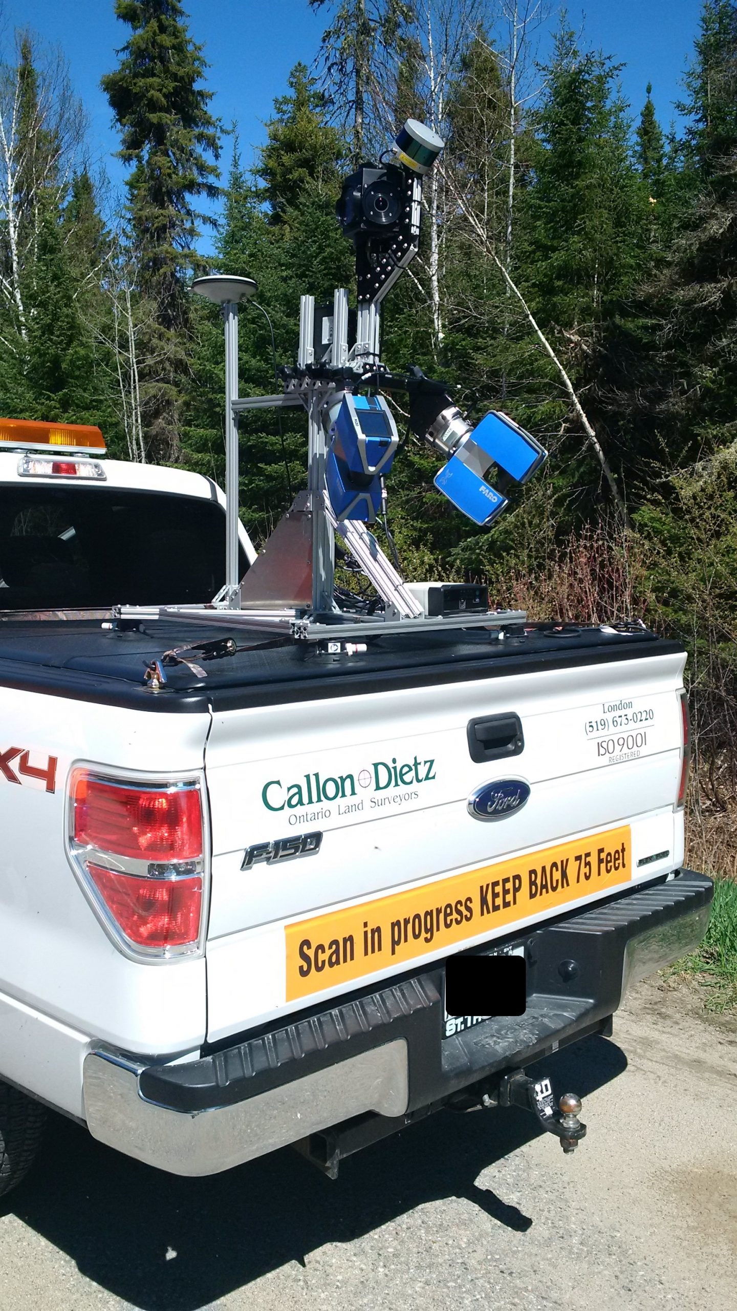
The City, as part of its Asset Management Program, is undertaking a Mobile Light Detection and Ranging (LiDAR) scan project to capture all City of Mississauga assets along roads (right-of-ways), the Transitway and within above ground, City-owned parking lots. Assets being scanned and photographed include items such as light poles, benches, catchbasins, transit stops, traffic light devices and more.
The project gets underway on June, 20, 2022 and will take approximately 12 months to complete, depending upon weather. To begin, vehicles will be driving periodically during the summer months and increasing their frequency during the late fall/early winter months in 2022 and late spring/early summer months of 2023. As the City requires unobstructed views of the assets, times when trees have no leaves and when there is no snow on the ground are ideal for capturing the images. During other seasonal times when trees are in full leaf, vehicles will be focused on the City’s industrial areas and where tree cover is minimal.
“While the City does have an existing asset inventory, the images captured through this work will significantly enhance that inventory by providing us with precise locations, current conditions and detailed characteristics for each asset,” said Helen Chin-Donofrio, Director, Information and Technology. “The work is being conducted using vehicles that are equipped with a laser scanner and camera – no sound or IP capturing devices. These vehicles will be driving throughout the city and taking pictures every few seconds; very similar to how other companies capture street view images.”
The LiDAR technology being used will emit a pulsed light wave into the area being surveyed. The pulses bounce off objects and return to the sensor. Depending on the time it takes each pulse to return, the sensor is then able to calculate the distance it travelled. Repeating this millions of times per second allows for the creation of a precise 3-D survey of the area and the asset. LiDAR laser technology has been used safely for a number of years and manufacturers must follow and adhere to strict guidelines to ensure sensors pass all required eye safety standards.
Chin-Donofrio added, “The City is committed to protecting the privacy of residents and the public. As part of this work, we are ensuring compliance with all related aspects of the Municipal Freedom of Information and Protection of Privacy Act (MFIPPA). As such, all identifiable features such as faces and licence plates will be blurred so they are unrecognizable. The data we capture will be used for the internal purpose of accurately recording and tracking our asset inventory. It will be saved and stored on a secure server behind the City’s firewall.”
To minimize disruption to residents and commuters, scanning and photographing of major arterial roads will be conducted during early morning hours and at times when traffic is lighter, with collector roads being scanned and photographed during regular working hours.
Background
Asset Management Program Overview
The Asset Management Program helps the City manage its vast range of municipal assets.
The program helps to:
- Oversee the development of corporate standards
- Implement leading asset management practices and programs
The City must balance a multitude of competing spending priorities with limited resources. As the city continues to grow, the need to make sustainable, well-timed infrastructure investments is essential. This helps to ensure we continue to deliver high-quality services for residents.
Media Contact:
City of Mississauga Media Relations
media@mississauga.ca
905-615-3200, ext. 5232
TTY: 905-896-5151