Traffic flow
Our studies show that eliminating a lane on each side of the street will not slow down traffic much at all.
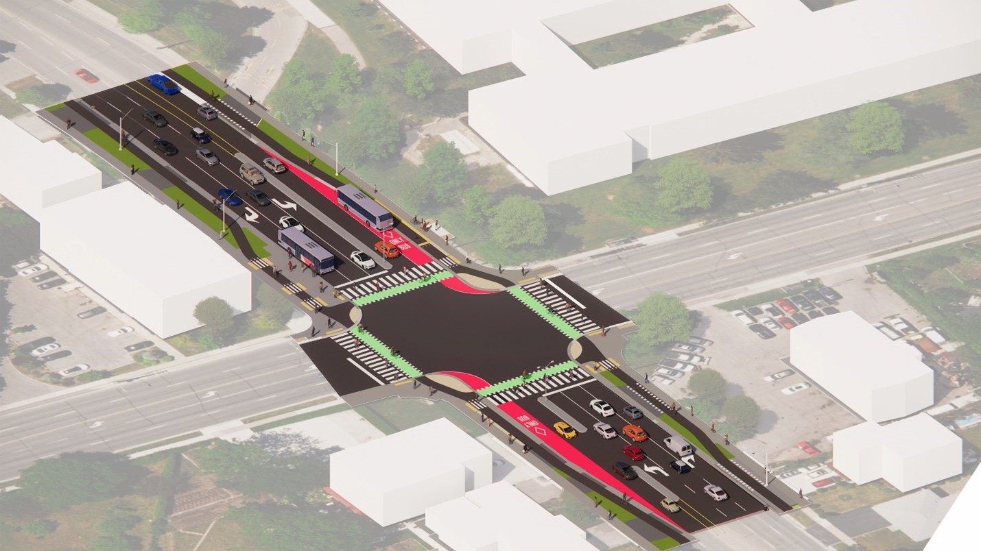
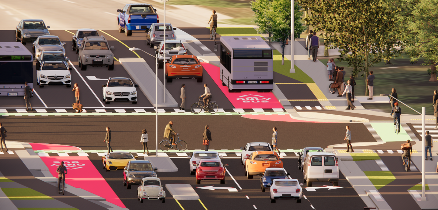
- The centre left turn lane will allow people to access driveways, without blocking traffic behind them
- Intersections will be safer for drivers, pedestrians and cyclists
- Tighter turning radiuses at corners will make it safer for pedestrians to cross and for drivers to see pedestrians
As the street is currently designed, speeds on Bloor Street are higher than the current speed limit (50 km per hour) because people feel comfortable driving fast.
The faster you drive, the stronger the impact during a collision. Slowing down not only reduces your risk of collision, it also significantly lowers the severity of injuries if a collision does happen. In the case of vulnerable road users such as pedestrians and cyclists, there is only a 15 per cent survival rate if struck by a vehicle travelling at 50 km per hour, compared to a 90 per cent survival rate if the vehicle is travelling at 30 km per hour.
Reducing a lane in each direction will slow speeds to the current speed limit and prevent serious injury for drivers, pedestrians and cyclists while still getting people where they want to go on time.
Speed studies
The City has completed historical and recent traffic studies measuring the rate of speed along the Bloor Street corridor.
The studies found that 15 to 45% of motorists do not follow the posted speed limit of 50 km per hour. The average speed measures approximately 10 km over the posted speed limit. Meanwhile, a significant percentage of drivers travel approximately 20 km over the speed limit.
Traffic studies
The City’s long-term transportation model shows that during the afternoon peak hours up to two-thirds of traffic on Bloor doesn’t start or end within the community.
The alternative design 6 with one travel lane in each direction will help slow down drivers to meet the existing speed limits, making it safer for everyone.
Buses can use lay-bys to pick up and drop off passengers. Lay-bys are added wherever possible (when they don’t conflict with driveways) to allow traffic to flow.
Staff analyzed the traffic operations of alternative 6. Staff compared travel during the busiest time of day (afternoon peak hour) of the westbound traffic along Bloor Street from Etobicoke Creek to Central Parkway East. The results included current impacts to 2041 (which figure in population and employment growth):
- Today, the trip takes about 11 minutes
- Alternative 5: about 11.5 minutes
- Alternative 6: about 9.5 min
Lower travel times for alternative 6 by 2041 are a result of Bloor Street becoming a less attractive thoroughfare. Burnhamthorpe Road and Dundas Street will become a better choice for longer distance trips and the increased traffic on Burnhamthorpe Road and Dundas Street during rush hour will be about one to three extra cars per minute by 2041.
Of course, during construction temporary impacts on Bloor Street will cause the traffic to ebb and flow.
Emergency services
Many studies reviewed the impact of changing four-lane roads to three lanes for emergency vehicles. These studies show that three-lane roads create easier and safer paths for emergency vehicles compared to four-lane configurations. In four lane traffic, emergency vehicles need two lanes of traffic merging out of their path. If drivers are not aware of the emergency vehicle or if there is no space for them to safely merge to the right, the emergency vehicle is delayed.
On roads with three lanes, there are fewer cars in the turning lanes which makes it easier and more predictable for those cars to pull out of that lane. Emergency vehicles can use the cleared centre two-way lane to travel to the emergency. Often, response times are improved with three lanes instead of four.
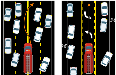
The image on the left shows a fire truck navigating the centre of a four-lane roadway and the resulting unpredictable movement of the cars moving off to the sides to clear a pathway.
The image on the right shows a predictable and safer pathway for a fire truck to move through the centre, two-way left-turn lane and cars moving off to the sides.
Safety designs
Hundreds of people use the Applewood Trail daily, including people along Bloor Street and in the surrounding neighbourhoods. These people need a safe and easy crosswalk to get across Bloor Street.
We will be adding a new mid-block, signalized pedestrian crossing at Applewood Trail so people can cross the street safely.
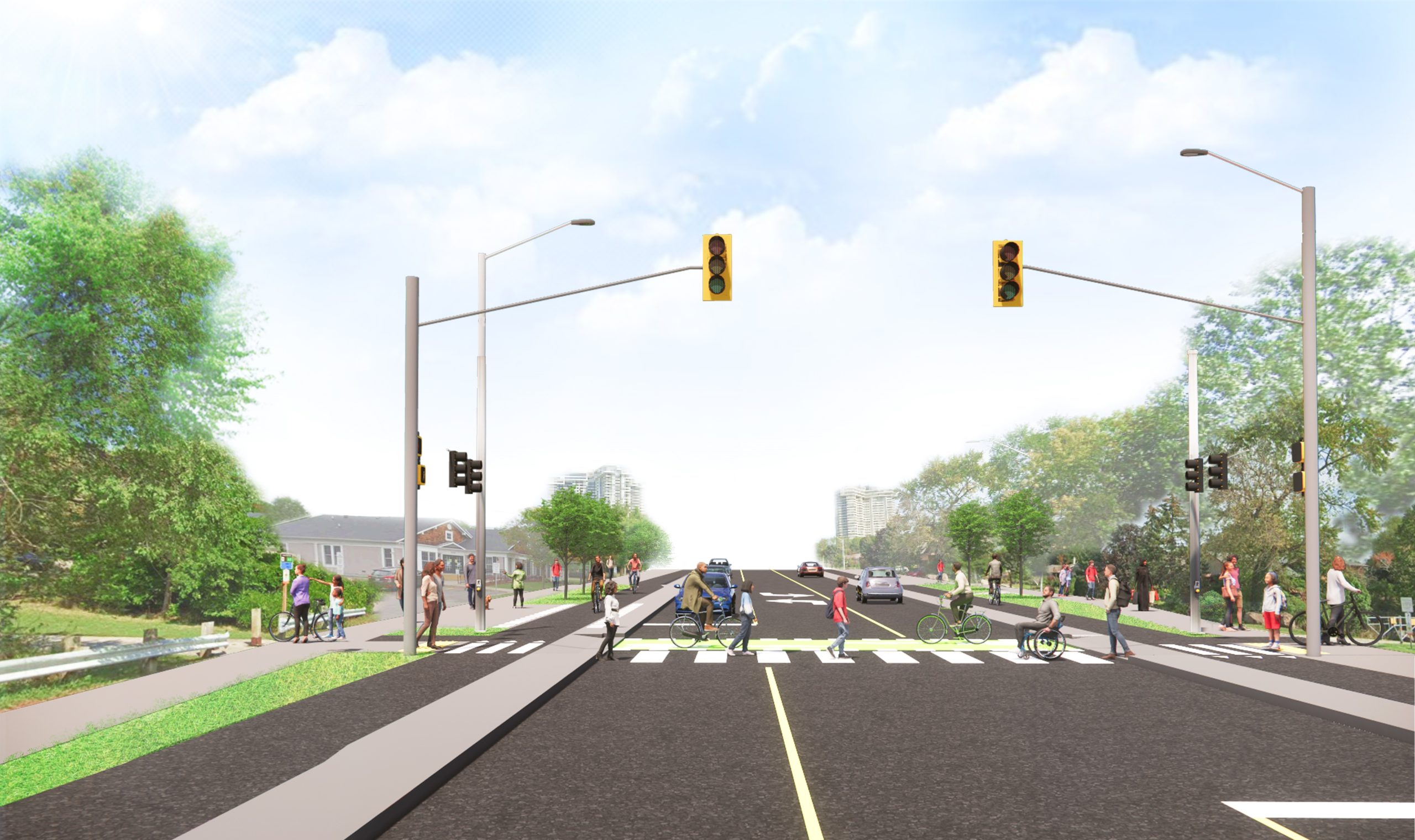
Intersections will also have better ramping, tactile warning plates, improved signage and markings that meet the Accessibility for Ontarians with Disabilities Act requirements.
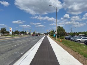
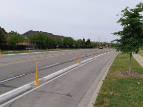
On Bloor Street we are adding cycle tracks to the boulevard instead of bike lanes to the roadway.
Bike lanes are integrated with the roadway while cycle tracks are separated from the roadway and are at the same elevation as sidewalks.
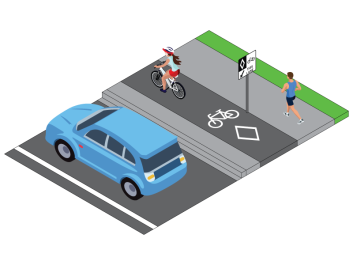
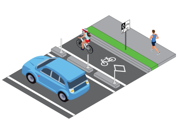
This is a main corridor and a place where cyclists – both recreational and commuter – should be able to ride safely. Plus, there is a direct connection to the Applewood Trail, which will allow people to travel through our community on their bikes safely.
Adding cycle tracks to Bloor Street will allow and encourage more people to get on their bikes and ride instead of using the car. You can still drive, if you want, but you will have the option to ride your bike too.
Cycling connections
Dedicated cycling infrastructure that is physically separated from traffic makes connections safer and more comfortable for everyone, regardless of age or ability.
The new cycle tracks along Bloor Street will provide direct connections to Applewood Heights Secondary School, Applewood Hills Plaza, Fieldgate Plaza, High Point Mall, the Mississauga Valley Community Centre, the Applewood Trail, the Chechalck trail, many parks and hundreds of homes.
In the surrounding Bloor Street area the connections and opportunities continue to grow with access to the Burnhamthorpe Community Centre, the Burnhamthorpe Library, the Hazel McCallion LRT, Mississauga City Centre including City Hall and the City Centre Transit Terminal, many more schools, shopping, parks, trails, jobs, and homes of friends and family.
Building protected cycling infrastructure along Bloor Street will help make Mississauga’s transportation network more equitable with safe access to necessities including food, services, education, jobs and community.
If you’ve ever ridden your bike in a live lane of traffic, or even in a painted bike lane, you know that it can be frightening. We’re working to change this in as many areas around the city where it makes sense to do so, including Bloor Street. We build protected spaces for bicycles so people feel safe to ride.
Streets and roads should be safe for everyone who wants to use them, whether you drive, take transit, walk or even bike. The City’s Cycling Master Plan aims to make Mississauga a bike-friendly city and build 900 km of bike infrastructure in the next 25 years.
If bike lanes are not protected and safe, most people won’t ride in them. Riding on the road beside cars, trucks and buses, without any protection, is not fun.
All around the world, when protected bike lanes are installed, more people ride in them. It doesn’t happen overnight, but over time, more people ride their bikes. We built roads to accommodate cars and we are doing the same with protected bike lanes.
We will install a number of safety measures, including:
- Accessible transit stops
- Better ramping, tactile warning plates, improved signage and markings that meet the Accessibility for Ontarians with Disabilities Act requirements
- Dedicated space (called crossrides) for cyclists to ride through intersections safely without having to get off their bike
- Narrower travel lanes to make drivers pay attention more and slow down
- New street light poles to make walking and driving at night safer
- Reduced curb radiuses at all intersections which slows traffic and makes it easier for drivers to see pedestrians
A big part of this project is to make the road safer for everybody.
Mississauga is committed to Vision Zero, which is our pledge to have zero injuries or deaths on our roads. We do this by lowering speeds and by protecting everyone who uses our roadways.
We know many people drive, but not everyone does. For those who don’t, they should still be safe on our streets.
