Overview
The City of Mississauga is developing pedestrian bridges as part of a new trail system in the northern portion of Credit Meadows (the former Harris Lands). A Municipal Class Environmental Assessment (MCEA) has been completed and was carried out in accordance with the requirements of a Schedule B undertaking as outlined in the Municipal Engineers Association Municipal Class Environmental Assessment Manual (October 2000, as amended 2007, 2011 and 2015), which is an approved process under the Ontario Environmental Assessment Act.
Public engagement
The City postponed in-person public engagement based on public health recommendations around COVID-19 and the need for physical distancing. The City provided a virtual public information centre, see Public Information presentation slides or watch the recorded presentation for more information.
Project summary
The final step in the MCEA process was to allow the public to review and comment on the Environmental Assessment (EA) documents for a period of 33 days, ending on February 8, 2021. During this period, a person or party could have requested that the Minister of the Environment make an Order for the project to comply with Part II of the Environmental Assessment Act (referred to as a Part II Order), which addresses individual Environmental Assessments. Such a request is only permissible where issues related to Aboriginal or Treaty Rights have not been resolved in discussion with the City. No such concerns were raised.
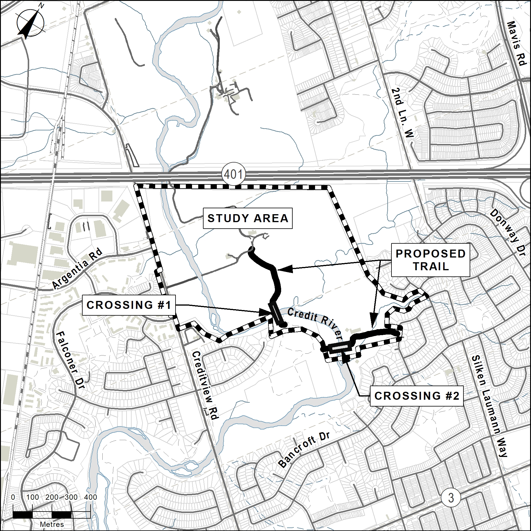
No Aboriginal or Treaty Rights were received. Other comments were received and these were carefully reviewed and considered. Based on technical studies and comments received from the public, agencies and Indigenous communities throughout the MCEA and final 33 day review period, it was determined that the preferred solution is the “Southern Route”. Relative to the other options studied, the Southern Route will result in fewer impacts to the natural environment, it will be easiest to construct and will provide the shortest and most straightforward connection between the neighbourhoods east and west side of the Credit River, and between the former Harris lands and Credit Meadows to the south.
The MCEA was completed in March 2021 confirming the preferred route as Alternative 3 – Southern Route. The Credit Meadows park expansion will follow the recommendations of the MCEA and be developed in phases over time.
See the project notice of completion and final report documents.
Credit Meadows Park expansion
Upon the completion of this MCEA in 2021, a related project is underway south of the MCEA study area. The project will expand Credit Meadows Park trails and connect them to the proposed bridges. This will also join the park with the former Harris Lands. Learn more about the trail expansion and project developments at Credit Meadows Park.