Background
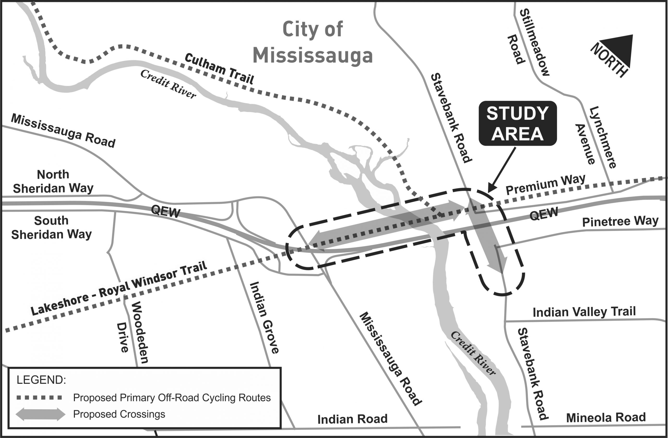
The City’s Cycling Master Plan (2010) and the Region of Peel’s Active Transportation Plan (2012) identified the need for a north-south Active Transportation (AT) crossing of the QEW at Stavebank Road. The Master Plan also identified the need for an east-west AT crossing of the Credit River near the QEW.
The proposed crossings will be important to the connectivity to the planned AT network, which includes the Culham Trail running north-south from the QEW, and the east-west Lakeshore-Royal Windsor Trail, the trail is envisioned to traverse the City of Mississauga from Halton Region to the City of Toronto.
The City of Mississauga, in partnership with the Region of Peel, has commenced the Detail Design Assignment with the Ministry of Transportation for the north-south AT crossing of the QEW at Stavebank Road and the east-west AT crossing of the Credit River near the QEW.
Study area map
Project updates
In 2024, Indigenous artifacts were discovered in the construction area and work paused due to archaeological investigations. For the latest updates, visit the Ministry’s QEW/Credit River improvement project site.
Project documents
December 1, 2016 Community Meeting
Project Notices
Project contact
Raniel Pinto, P.Eng. – Capital Project Manager
905-615-3200 ext. 4778
raniel.pinto@mississauga.ca