Detailed design phase
The Dixie-Dundas community is subject to flooding as a result of spilling from Little Etobicoke Creek near the Dixie Road bridge during high flow conditions. This project will implement a flood mitigation solution to protect residences and businesses and help future growth in the community.
A proposed flood mitigation solution was identified during the initial Environmental Assessment phase, which includes widening and deepening the creek, bridge replacements, utility relocations, and trail improvements, among other upgrades.
We’re now in the detailed design phase, which includes the following tasks:
- Conduct field investigations to support the design work
- Acquire lands for the proposed solution
- Coordinate with key stakeholders
- Relocate key utilities before construction begins
- Pre-qualify construction contractors
- Set up the construction schedule
- Select the engineering company for construction
Project updates
The tasks and activities that are currently underway include:
- Ecological surveying fieldwork, with many areas completed
- Utility surveying and mapping, mostly completed
- Geotechnical investigations within the Dixie Road area completed
- Archeological fieldwork expected to be completed in spring 2026
- Design work for key utility relocations
- Land acquisition with affected landowners
- Engagement and coordination with key stakeholders including TRCA, Region of Peel, and Dundas BRT
Anticipated schedule
| Task | Estimated start date | Estimated completion date |
| Geotechnical investigations | Spring 2026 (phase 2) | Phase 1 completed Fall 2026 (phase 2) |
| Ecological surveying | In-progress | Fall 2026 |
| Utility surveying | In-progress | Fall 2026 |
| Detailed design | In-progress | Fall 2026 |
| Land acquisition | In-progress | Late 2026 |
| Key utility relocations | In-progress | Late 2026 |
| Archaeological fieldwork | Spring 2026 | Spring 2026 |
| Pre-qualification for construction | Fall 2026 | Early 2027 |
| Construction | Early 2027 | Late 2028 |
Project details
Funding
In 2025, the federal government approved the project under the Canada Housing Infrastructure Fund (CHIF) for a contribution of $24.2 million to the City.
More recently, the provincial government’s Ministry of Infrastructure approved the project as part of the Municipal Housing Infrastructure Program (MHIP), Health and Safety Water Stream, for a contribution of $24.4 million to the City.
These contributions, combined with the City’s approved project budget, will ensure the project remains fully funded.
Environmental study
As part of the Environmental Assessment, the Environmental Study Report was completed in 2024 and documents the planning, decision-making and consultation process for this project.
We appreciate all of the consultation and feedback that was received for the report and throughout the study, which helped inform the preliminary design.
Public engagement
We held two Public Information Centres (PICs) to present information related to the study and gather community feedback to inform the preferred design alternative.
Public Information Centre #1 was held virtually in summer 2020, and Public Information Centre #2 was held in spring 2023.
Project documents
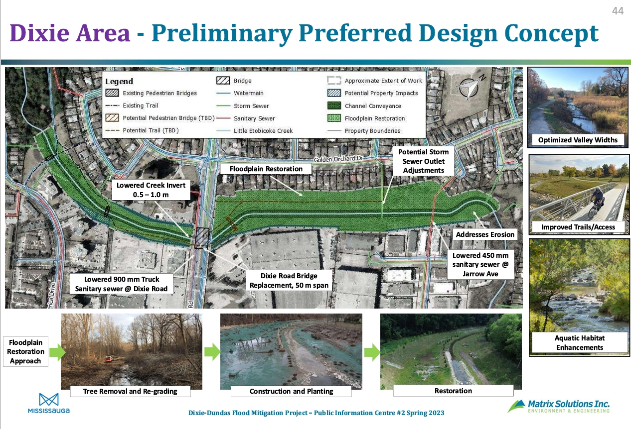
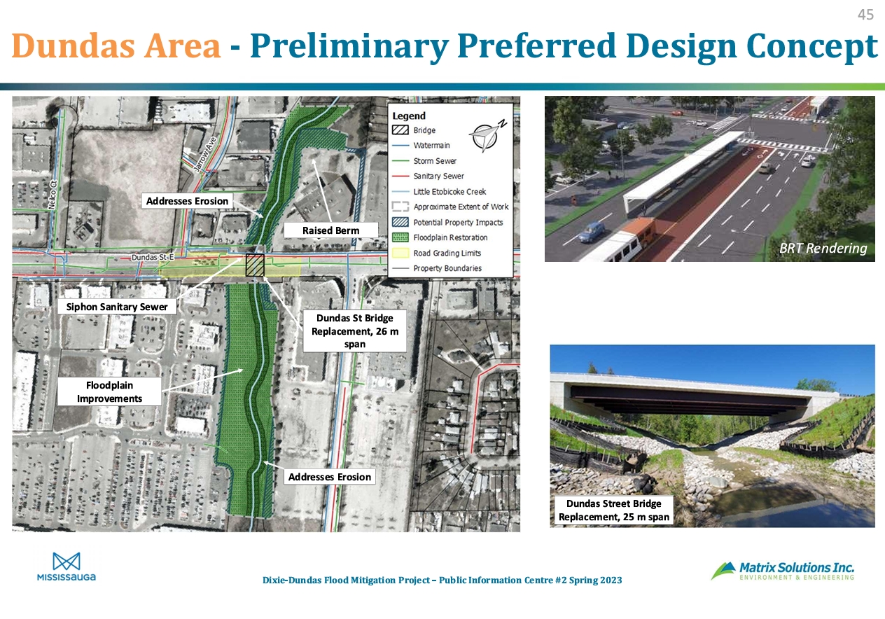
Below are the preliminary preferred design concepts for the Dixie and Dundas areas.
Contact
The project contact is Anthony DiGiandomenico, P.Eng., Project Manager.
For more information about this project or if you have questions, email anthony.digiandomenico@mississauga.ca.