-
1Phase 1: July to September 2025
Engage community groups and residents to kickstart project. Work with the community to identify key issues and neighbourhood context.
-
2Phase 2: October to December 2025
Engage community through workshops, focus groups and surveys. Gather input to inform the action plan, identify themes and project ideas.
-
3Phase 3: January to September 2026
Second workshop with key stakeholders to identify potential actions. Complete a demo project based on local interest. Draft the final action plan for public review and Council endorsement.
Overview
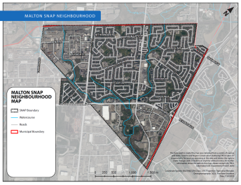
Malton is a well-established and diverse community located in northeast Mississauga with approximately 36,000 residents.
It lies mostly within the Mimico Creek watershed and intersects with the Humber River watershed. Malton features a mix of residential and employment areas, parks, schools, places of worship and a vibrant community centre.
The area is known for its cultural richness and strong community spirit, making it an ideal location for a sustainable neighbourhood action plan (SNAP).
Project details
The Toronto and Region Conservation Authority, in partnership with the City and Region of Peel, will develop the sustainable neighbourhood action plan for Malton.
The goal of the plan is to:
- Address sustainability challenges within the neighbourhood
- Align with the needs and priorities of the community
- Create action items that are achievable
- Create a more sustainable and resilient community
Malton SNAP neighbourhood map
Public engagement
Community pop-up event
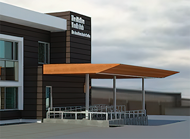
On November 23, 2025, a community pop-up event was held at the Malton Community Centre.
Project contact
For more information about this project, email Lajanthan.prabaharan@mississauga.ca.