Overview
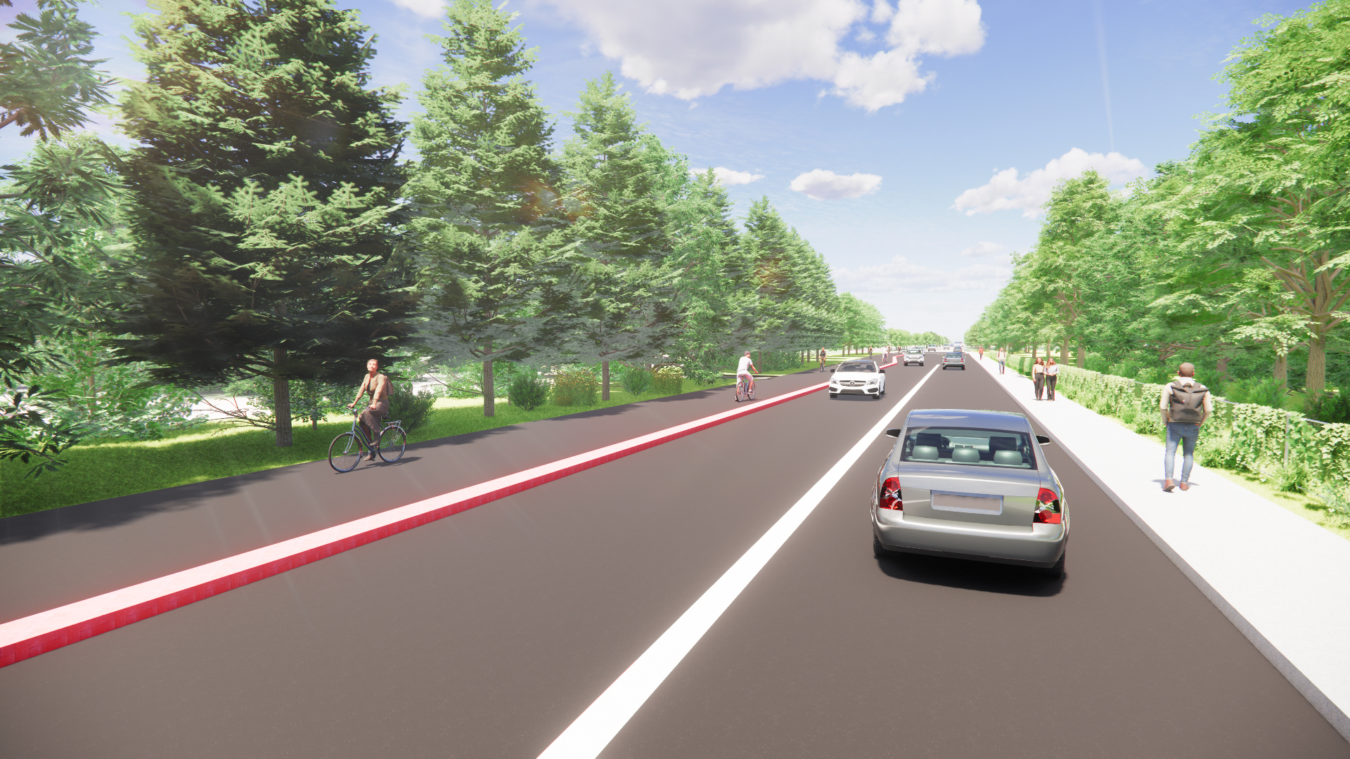
We are planning road improvements to McLaughlin Road Scenic Route corridor. The project will enhance safety and accessibility for pedestrians, cyclists and transit users while preserving the adjacent wood lot. Planned road improvements are supported by the Cycling Master Plan and will help advance the City’s Vision Zero policy.
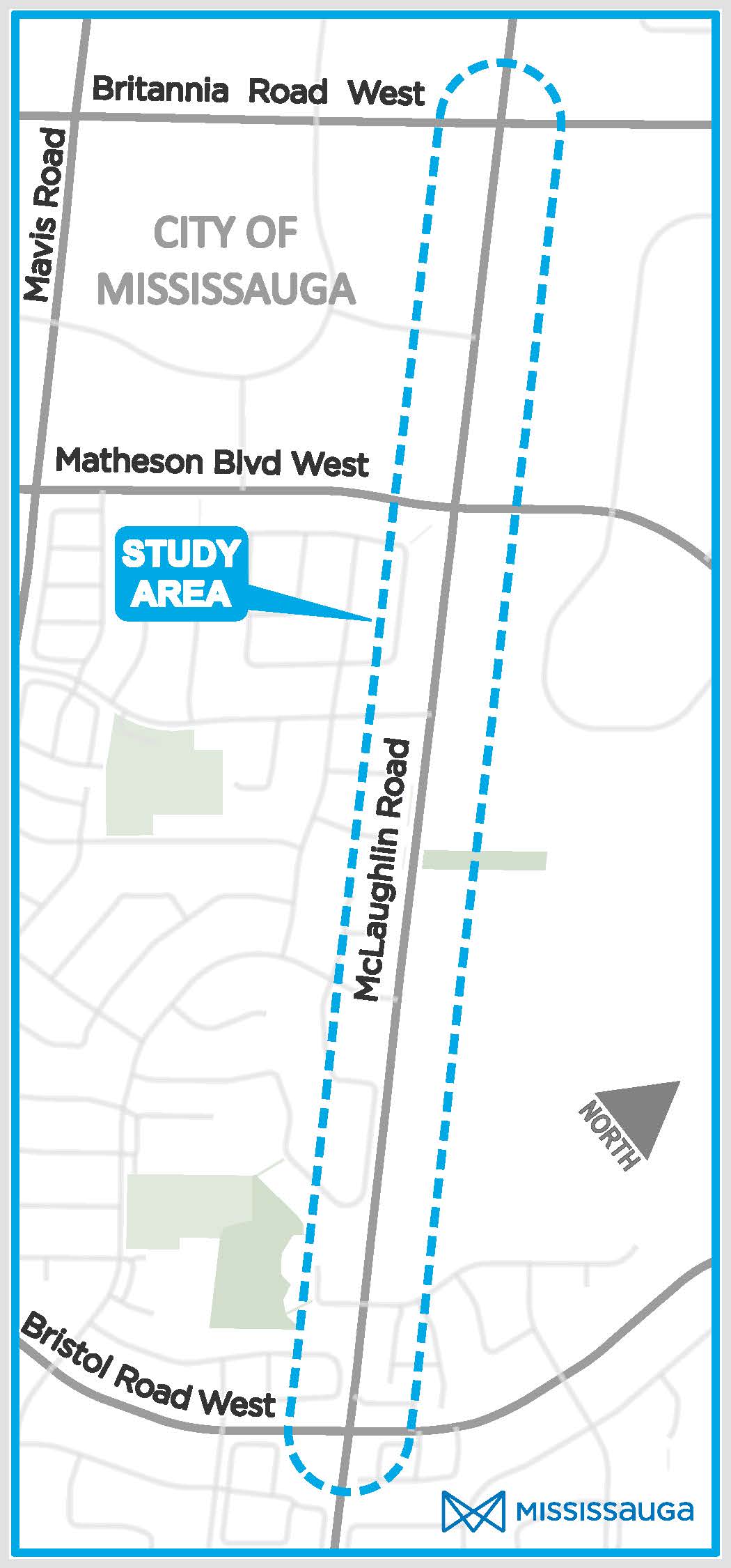
Area map
-
1Detailed design and tender phase: December 2025 to December 2026
Secure all required permits and approvals, develop the detailed design, issue tender, conduct bid selection process and award contract.
-
2Utility relocations: July 2026 to April 2027
Relocate or adjust existing underground and above-ground utilities to accommodate the proposed Active Transportation facilities.
-
3Construction phase: April 2027 to December 2027
Implement the proposed improvements and design features.
-
4Restoration phase: March to August 2028
Complete final restoration work, including sod installation and tree planting.
To streamline the planning, funding, public engagement, design and construction phases of the project, the City is taking an integrated approach. This approach will help to reduce redundancy, minimize disruptions to the community and ensure all planned improvements are aligned and coordinated.
The project will focus on road safety following the Vision Zero Action Plan, intersection controls, street lighting, active transportation and transit infrastructure. The improvements will be made while preserving the Scenic Route and adjacent wood lot.
Improvements include (but are not limited to):
- Pavement rehabilitation
- Curb replacements and realignment
- Street light pole replacements and illumination upgrades
- Additional boulevard trees
- Utility relocations (where required)
- Improved sidewalks
- New cycling facilities along the entire corridor
- New traffic signals at Regal Drive, Avonwick Avenue, and Faith Drive/Parkwood Place for safer pedestrian and cyclist crossings
- Crossrides at all signalized and non-signalized intersections
- Protected intersections (exact configuration to be confirmed during detailed design)
- Transit stop improvements
We have completed the planning and preliminary design study. The preliminary design (also called “preferred design alternative”) was selected based on technical evaluation and community feedback. The project is now in the detailed design phase. Learn more about how we will address neighbourhood concerns.
Background
On January 14, 2016, the City issued a Notice of Study Completion for the review of the final Environmental Study Report (ESR). However, on February 24, 2016, Council passed a resolution to remove the McLaughlin Road improvement project from the City’s Capital Program for the lifespan of the Class EA documentation. Following the resolution, the City formally withdrew its Notice of Study Completion for the Class EA Study.
Following the resolution and withdrawal, the City initiated a planning and preliminary design study for road improvements to McLaughlin Road Scenic Route corridor. The project is planned under ‘Schedule A+’ of the Municipal Class Environmental Assessment process (October 2000, as amended in 2015), which is approved under the Ontario Environmental Assessment Act.