Overview
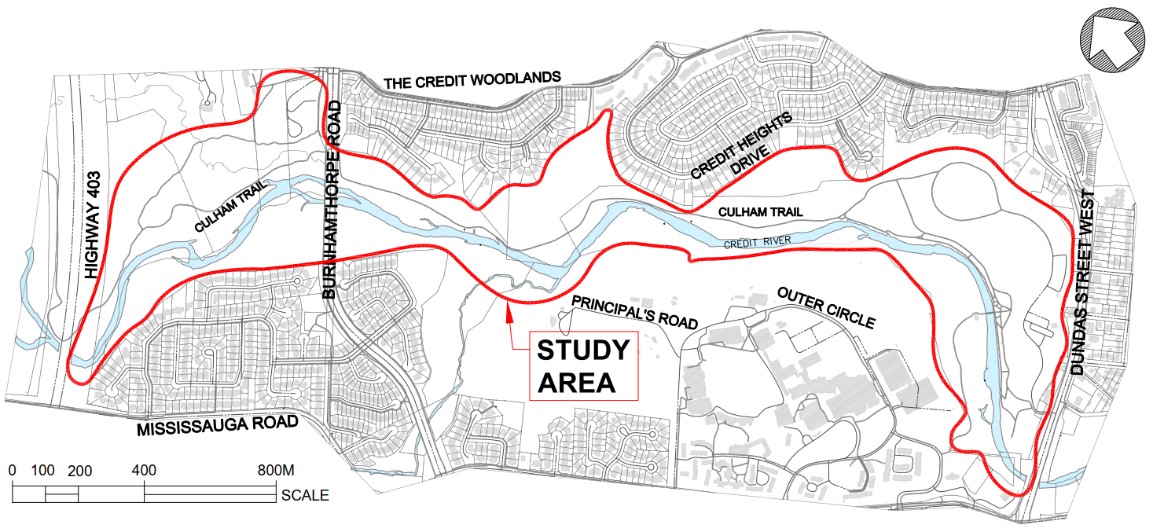
Seasonal rain washes away gravel and sand, damaging the Culham Trail along the Credit River. As the city’s main drainage feature, the Credit River transports a high volume of water, causing bank erosion over time. To fix these concerns, the City completed an environmental assessment in 2024 for the study area below. Long-term solutions for the area will:
- Protect existing infrastructure
- Increase trail safety
- Enhance the ecological habitat
- Provide erosion protection measures
-
12025
Project study completed
-
22026
Detailed design phase
-
32027
Construction begins
Project updates
The project is now in the detailed design phase, which includes:
- Coordinating with key stakeholders, including Region of Peel, Credit Valley Conservation, Department of Fisheries and Oceans, and the Riverwood Conservancy
- Completing detailed design drawings, including erosion control design, trail designs, removals and restoration designs
- Tendering construction
- Setting up construction schedules
Public engagement
The City hosted a public meeting at Visual Arts Mississauga on October 1, 2026.
Project documents
The Project File Report from the 2024 environmental assessment outlines the planning, decision-making, and consultation process for this project. Consultation feedback throughout the study helped inform the preliminary design.
Contact
If you need more information or have questions or comments, contact Evelyn Krolicka Lewis at evelyn.krolicka@mississauga.ca.