Rathburn Road East and Ponytrail Drive are included in the City’s Annual Asphalt Resurfacing Program. This resurfacing work was initially identified through the City’s Annual Road Needs study, pavement quality index and field observation. The rehabilitation work includes:
- Asphalt resurfacing
- Curb and sidewalk replacement
- Catchbasin and maintenance hole adjustments and repairs
- Subdrain installation
- Driveway apron repairs
- Sod replacement
The City’s Cycling Master Plan recommends new cycling facilities along Rathburn Road East and Ponytrail Drive.
The City evaluated potential cycling facilities along the two road corridors taking into consideration safety and mobility challenges and opportunities along the corridors. The following are the cycling facilities implemented as part of this project:
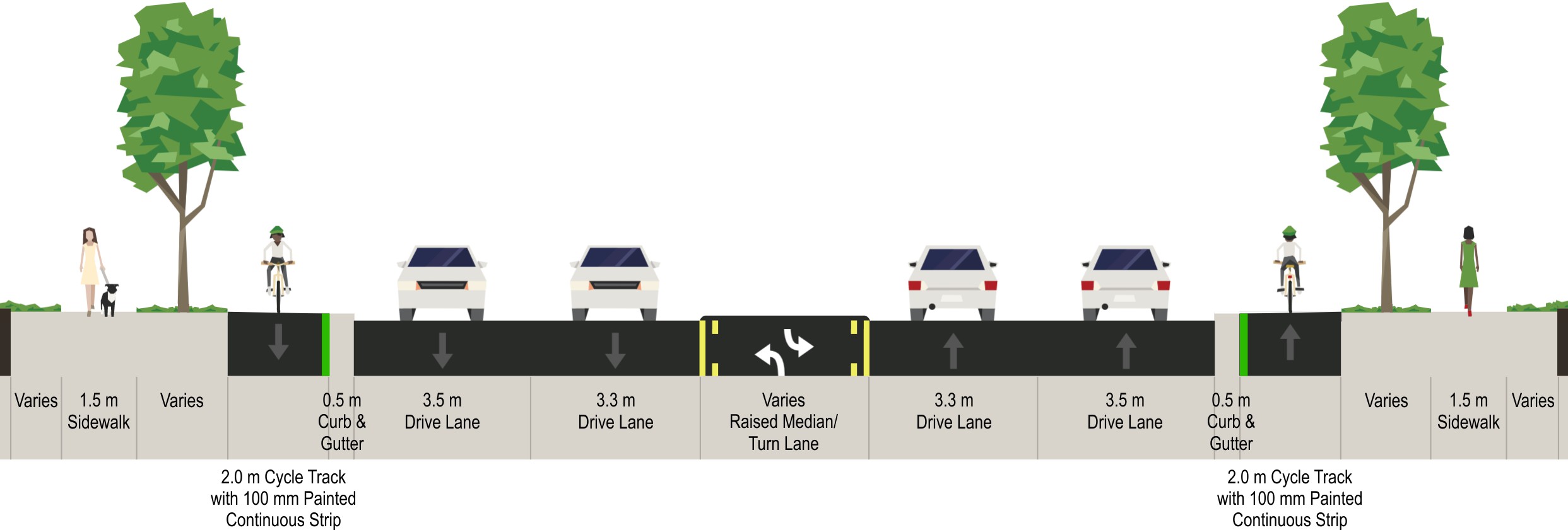
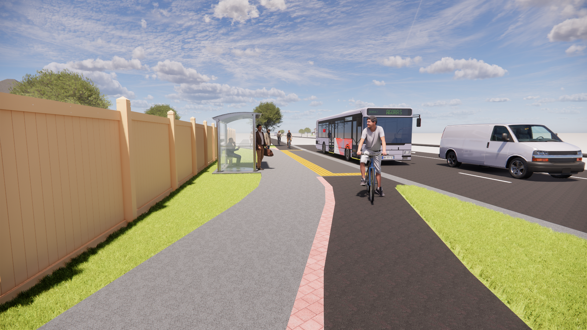
- Construction of a one-way cycle track on both sides of the roadway along Rathburn Road East from Dixie Road to Ponytrail Drive and along Ponytrail Drive from Rathburn Road East to Burnhamthorpe Road. The following is a rendering of a roadway cross-section with a one-way cycle track:
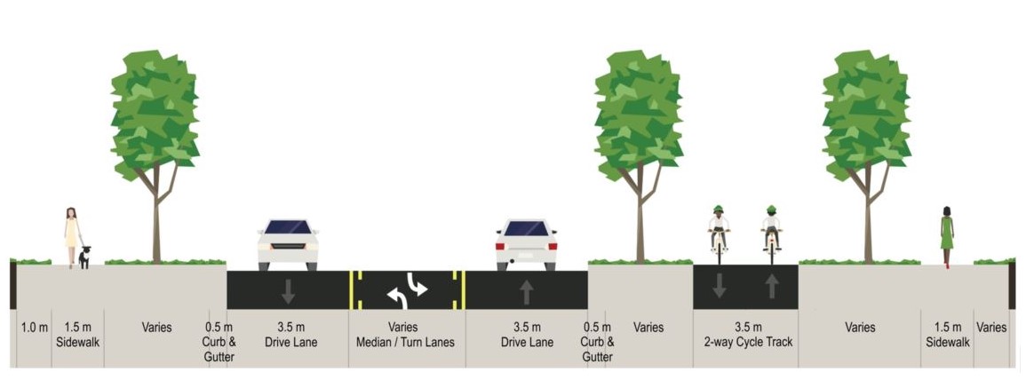
- Construction of a two-way cycle track along the east side of Rathburn Road East from Ponytrail Drive to the East Limits. The following is a rendering of a roadway cross-section with a two-way cycle track:
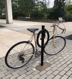
- Construction of bike parking infrastructure within the road corridors. The following is an image of the City’s standard bike rack:
The City is committed to taking the Vision Zero approach to road safety on all City projects. In an effort to contribute to the Vision Zero goal of eliminating traffic-related fatalities and serious injuries on both road corridors, the City implemented intersection and pedestrian safety improvements.
The following is a summary of the road safety improvements along the two road corridors:
- Elimination of channelized right turn lanes at the intersection of Ponytrail Drive and Rathburn Road East
- Implementation of narrower lanes
- Reduction of the curb radii at all intersection corners
- Upgrades to the connections to the existing concrete sidewalks
- Enhancement of treatments to meet AODA standards, including ramping, tactile warning plates, signage, and pavement markings
- Improvements to existing pedestrian crosswalks throughout the project area, as well as new signalized crossings at Ponytrail Drive and Shaver Trail, and Rathburn Road East and Off Road Trail 11 (Hydro One corridor)
- Upgrades to street lighting and traffic signals for vehicles and cyclists, including new traffic signals at the intersection of Rathburn Road East and Rockwood Road
The road improvements result in an overall reduction of hard surface area, which decreases the amount of stormwater runoff within the project area. In addition, stormwater quantity and quality control measures are provided through the implementation of Best Management Practices (BMPs), including Low Impact Developments (LID) practices.
The LID measures consist of bioswales. The locations of the LID measures are on the east side of Rathburn Road East from Ponytrail Drive to the east limits of the City as identified in the Preferred Design Concept plans included in the PDR available under the Resources Page.
The City conducted an inspection of the existing Ponytrail Drive Over Etobicoke Creek Tributary culvert. The inspection revealed that this culvert is in poor condition. As a result, the City has replaced this culvert as part of this project.
Rathburn Road East and Ponytrail Drive are currently served by MiWay Route 20 with 14 bus stops along the road corridors.
The City reviewed the existing MiWay infrastructure along the road corridors and identified transit stop improvements.
The following renderings are of transit stop improvements the City has implemented as part of this project.
Bus stops where cycle tracks are separate from bus stop platforms. These are located within wide boulevards where there is more space available.
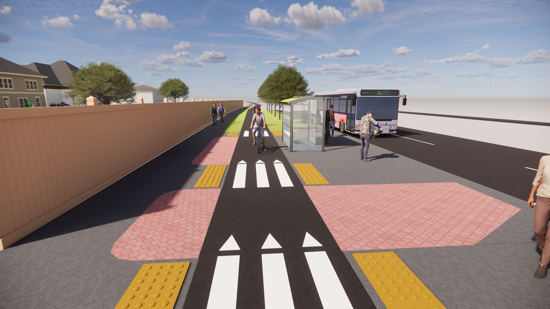
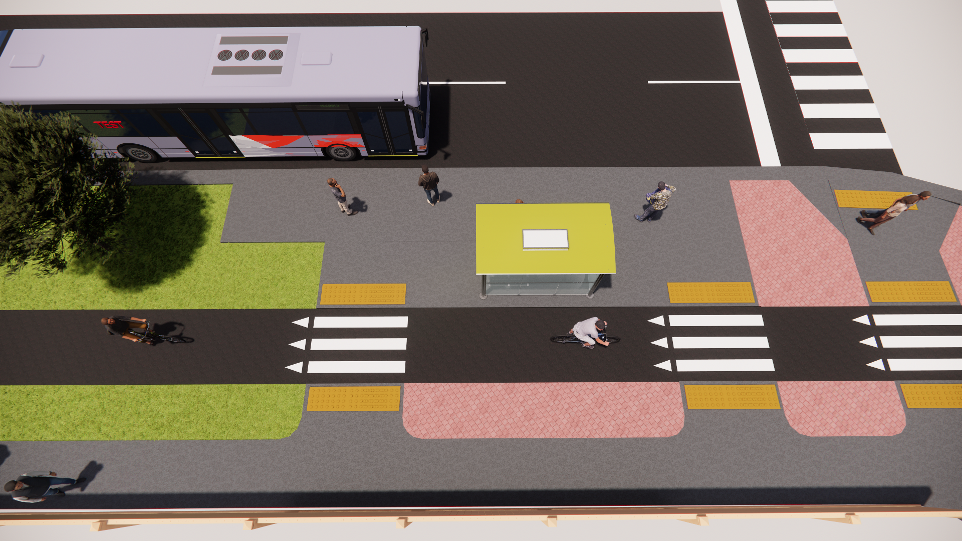
Bus stops where cycle tracks and bus stop platforms are combined. These are located within narrow boulevards where there is limited space.

The City completed a noise assessment along both road corridors and identified gaps in the noise wall infrastructure.
Noise walls have been identified to be required at the following locations:
- Along both sides of Rathburn Road East from just west of Fieldgate Drive to the hydro corridor.
- On the east side of Ponytrail Drive from Rathburn Road to Burnhamthorpe Road and on the west side of Ponytrail Drive from Maple Ridge Road to Burnhamthorpe Road.
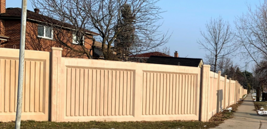
The City only proceeded with installing new noise walls where the property owners, who are directly impacted by the work, agreed with their installation. The following is an image of the City’s standard noise wall:
The City intends to incorporate green infrastructure elements along both road corridors. This is to improve the aesthetic quality and comfort of the corridor and address socio-environmental challenges, while taking into consideration the costs associated with maintenance obligations.
The City is making every effort to increase the number of trees in the project area, with a focus on meeting or exceeding the City’s tree replacement requirements. The City Forestry Department will assess the site after construction is complete to determine where trees can be planted.
The project team has also undertaken a thorough review of median treatment opportunities to maximize the number of landscaping features within the medians. This includes, but is not limited to, raised planters and/or shrubs and perennials and sod. For more information on median treatments, refer to the median treatment memo in the resources tab.
The City will install these plants:
- Gold Coast Juniper
- Karl Forester Feather Reed Grass
- Salsa Red Coneflower
- Rozanne Cranesbill Geranium
- Fountain Grass
- Indian Grass
- Little Bluestem
The number and species types within each median may vary depending on the space and availability.