Project overview
Sheridan Creek originates in the industrial lands north of the QEW, flows southeast through the study area and ultimately discharges to Rattray Marsh and Lake Ontario further southeast. This section of Sheridan Creek, which spans 700 metres, is channelized with many areas being concrete-lined approximately 40 to 50 years ago.
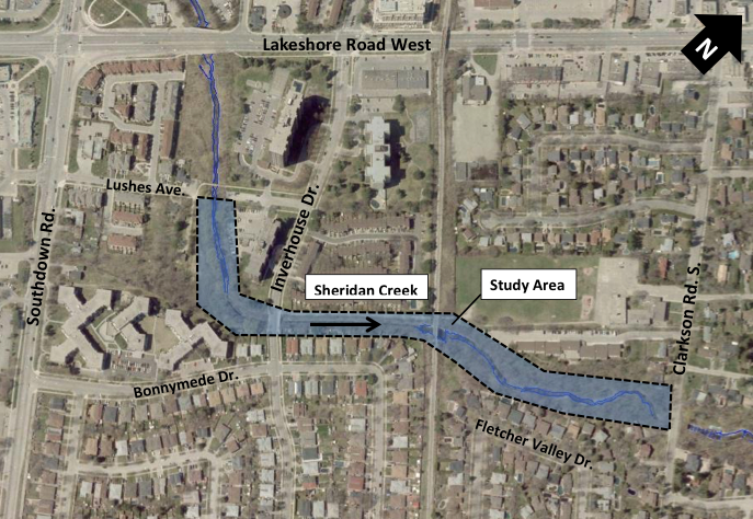
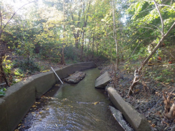
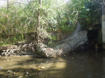
The concrete channel and gabion baskets are no longer functioning as designed, posing a risk to infrastructure and the environment. Excessive erosion has led to some of the following impacts: bank and valley wall destruction; slumping of gabion banks; and elevated storm sewer outfalls.
Through the City’s ongoing erosion monitoring program, this section of Sheridan Creek has been identified as requiring rehabilitation.
Objectives
The main goal of this project is to mitigate the existing erosion problems and ensure long-term stability of the creek using natural design techniques, where feasible, while also protecting or enhancing the existing environment within the study area.
Benefits
- Improves the stability and environmental health of the watercourse
- Maintains or improves the hydraulic capacity of the creek, and protects nearby property and infrastructure
- Improves fish habitat and fish passage
- Provides an opportunity for the planting of native species, and enhancing wildlife habitat where feasible
Online Public Information Centre
A Public Information Centre (PIC) for the Sheridan Creek EA was made available in October 2021. Through the MCEA process, the Project Team developed and evaluated alternative solutions for Sheridan Creek. A preliminary recommended solution was identified for public review and presented through the PIC. The presentation is available to the public.
Project File
A Project File has been prepared to document the planning, decision-making and consultation process for this study. The Project File is available to the public for review for a 30-day comment period starting January 25, 2023 to February 23, 2023.